
Discover Monte Baldo
Are you on vacation on Lake Garda and you would like to visit the mountains around it? A trip to Monte Baldo is what you are looking for if you love nature and hiking! In this article, I will show you the most beautiful trekking paths on Monte Baldo: a selection of must-visit places.
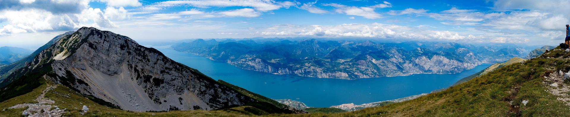
First of all, some information about this amazing place. Monte Baldo is the mountain chain on the east side of Lake Garda. It is almost 40 kilometers long and it separates Lake Garda from the Val d’Adige.
The name “Baldo” comes from the Lombard Wald, which means “forest” and it was used for the first time in the XII century. Giardino d’Europa (Europa’s Garden) is its second name because of its lush flora and its different climate areas. There are four climate zones and each one has its typical vegetation. Until 700 meters above sea level, there is the Mediterranean zone and from 700 to 1500 meters there is the mountain zone. Then, until 2000 meters there is the boreal zone, and over 2000 meters the alpine zone.
Monte Baldo is one of the most evocative places to visit on Lake Garda. Keep reading this article to discover all the things that this mountain has to offer!
The highest mountain tops
We can divide the mountain chain into two parts, Monte Baldo and Monte Altissimo. This second one is isolated from the other mountaintops. Which are the peaks of Monte Baldo? The main ones are:
- Altissimo (2078 m);
- Dos della Colma (1830 m);
- Cima Pozzette (2128 m);
- Cima del Longino (2180 m);
- Cima Valdritta (2218 m);
- Punta Pettorina (2191 m);
- Punta Telegrafo (2200 m);
- Cima Sascaga (2134 m);
- Vetta delle Buse (2154 m);
- Coal Santo (2072 m);
- Crinale di Costabella (2062 m);
- Cresta di Naole (1660 m).
Because of its trekking paths and its huts, Monte Baldo is full of tourists in the summertime. In wintertime is very popular too, because there are beautiful ski slopes overlooking Lake Garda.
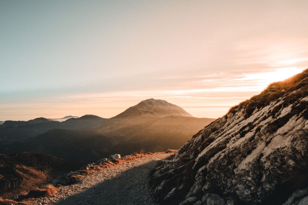
In this article, I will describe you the most famous places and paths you can find on Monte Baldo. Moreover, let’s not forget about the astonishing views!
What to do on Monte Baldo during summer
Monte Baldo offers different types of activities for all kinds of expertise.
The first thing that comes to my mind when thinking about the mountains is the infinite number of trekking paths. Some of them are for beginners and others for experienced hikers, but all of them reach cozy huts where you can eat something typical and homemade.
You can reach many of those lodges by mountain bike or on the back of a horse. If you are a little bit more fearless, the south part of Monte Baldo is the climbers’ heaven.
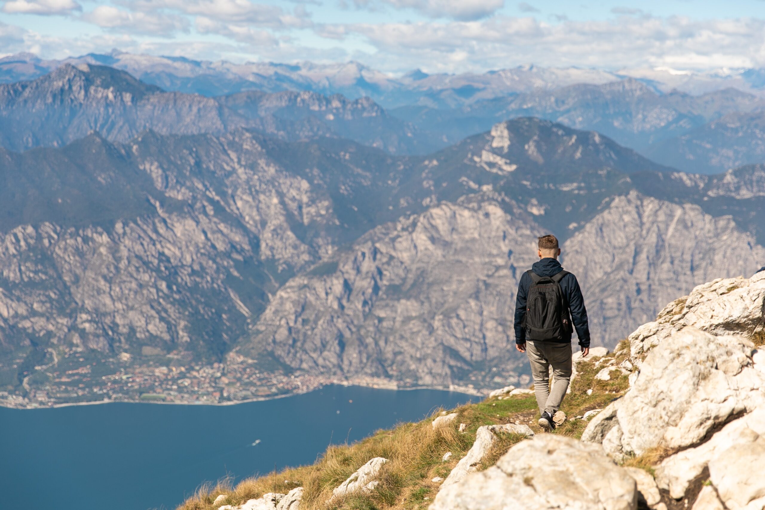
Are you a mountain lover looking for the place to visit on Lake Garda perfect for you? Here you can read about the best trekking paths on Monte Baldo.
1. TREKKING ON MONTE BALDO
2. TRAVERSATA DEL BALDO – PEAKS OF MONTE BALDO TOUR
3. DURING WINTER
1. TREKKING ON MONTE BALDO
The paragraphs below describe the best trekking paths on Monte Baldo. There is something for everyone, so let’s take a look!
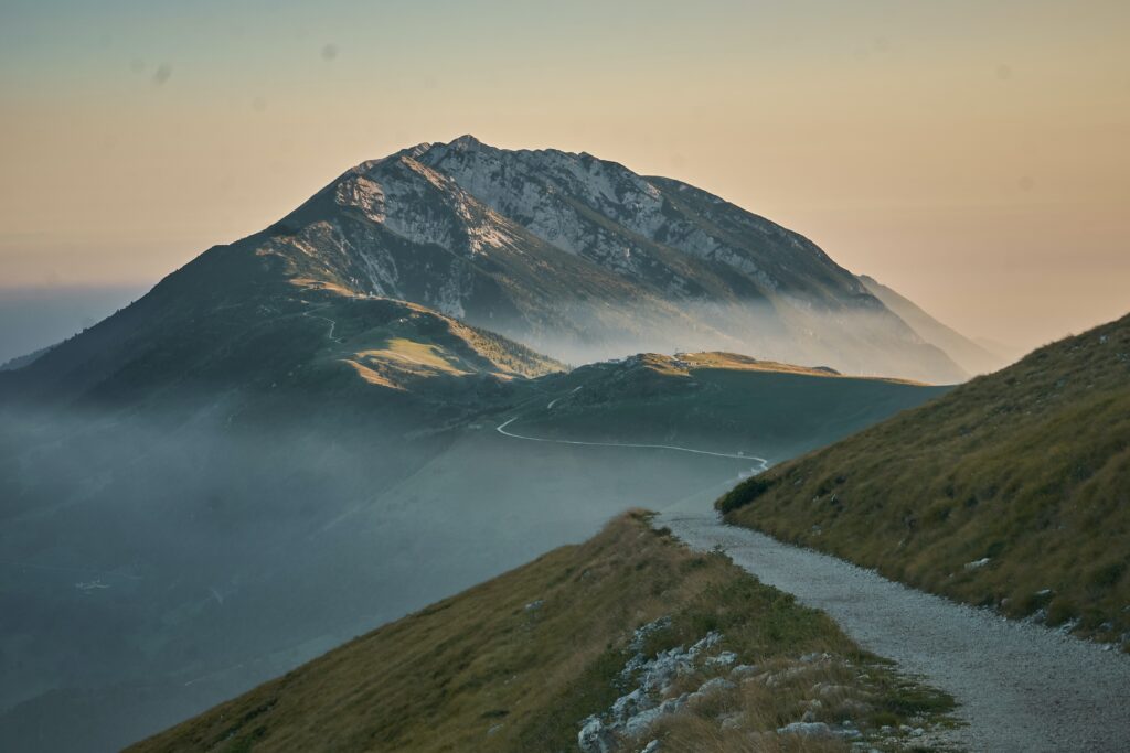
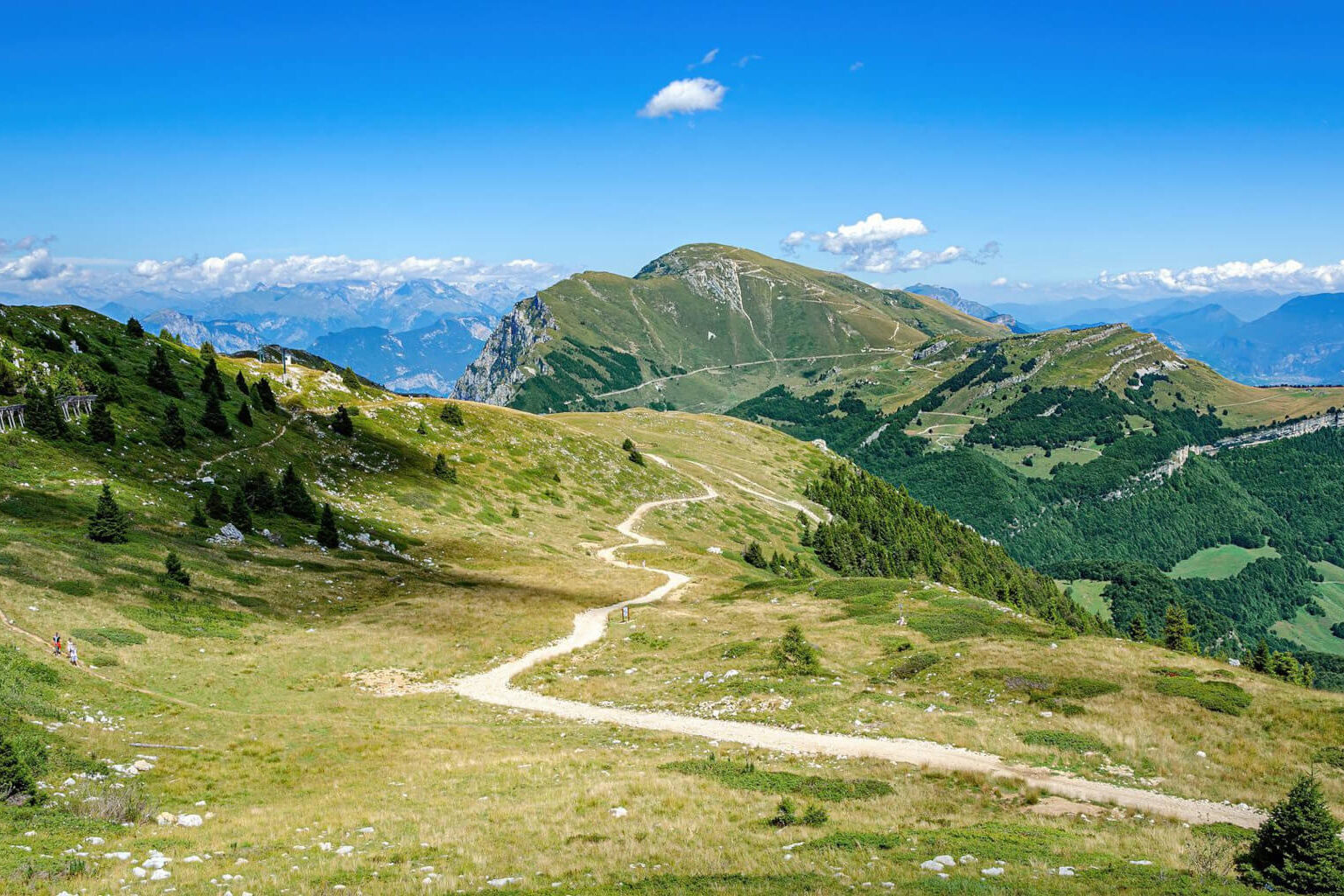
Crinale di Costabella
The first trekking path is one of the most popular ones. It offers astonishing views of Lake Garda and the mountains on the other side of Val d’Adige. You can go hiking, but also horseback riding and mountain bikes are more than welcome on this path!
The route begins from Le due Pozze, where you can find a parking spot for your car. Start by walking on the old military road that reaches the Ex Forte Naole until the crossroad with the path number 57. From here, after only two turns you get to Rifugio Fiori del Baldo (1816 m).
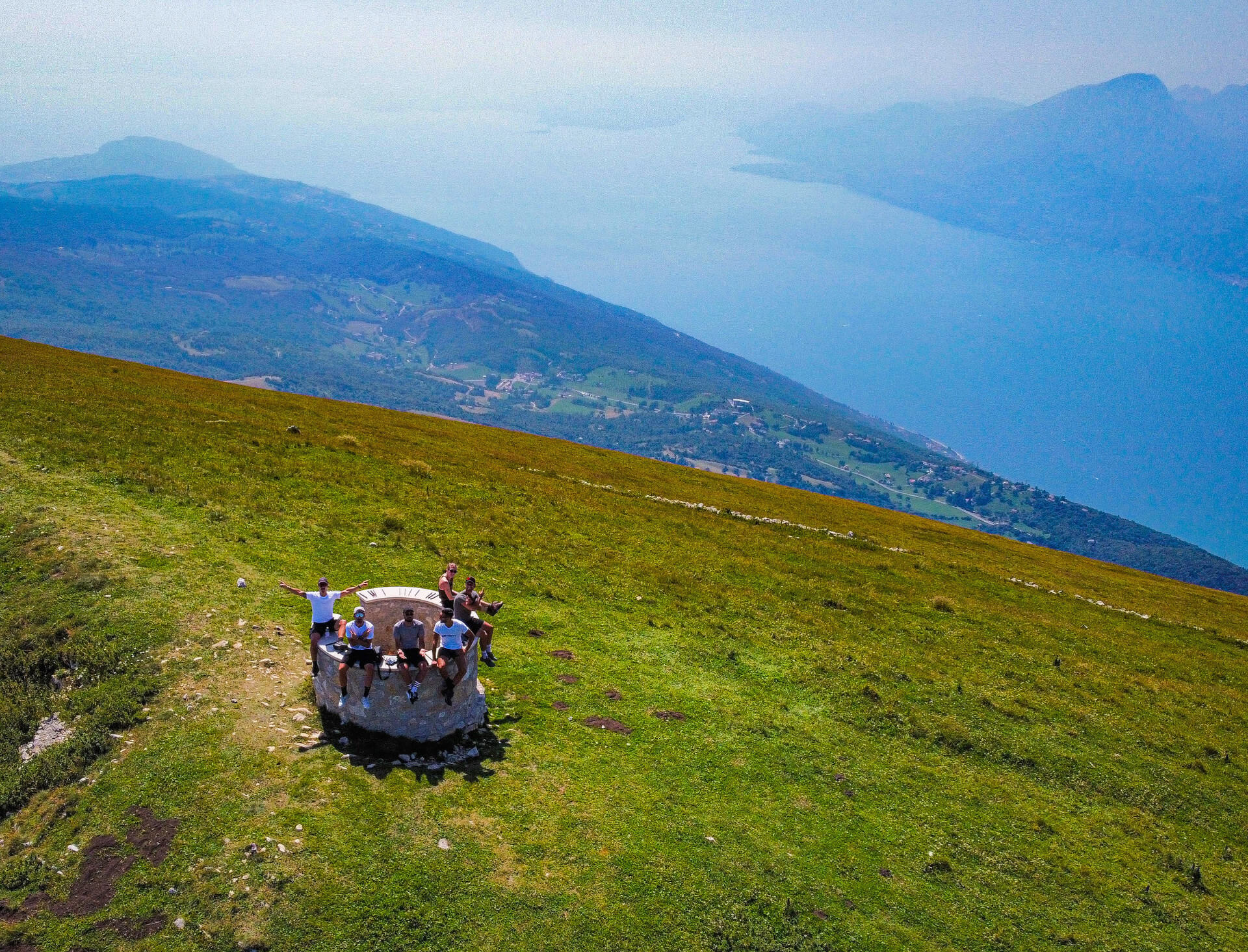
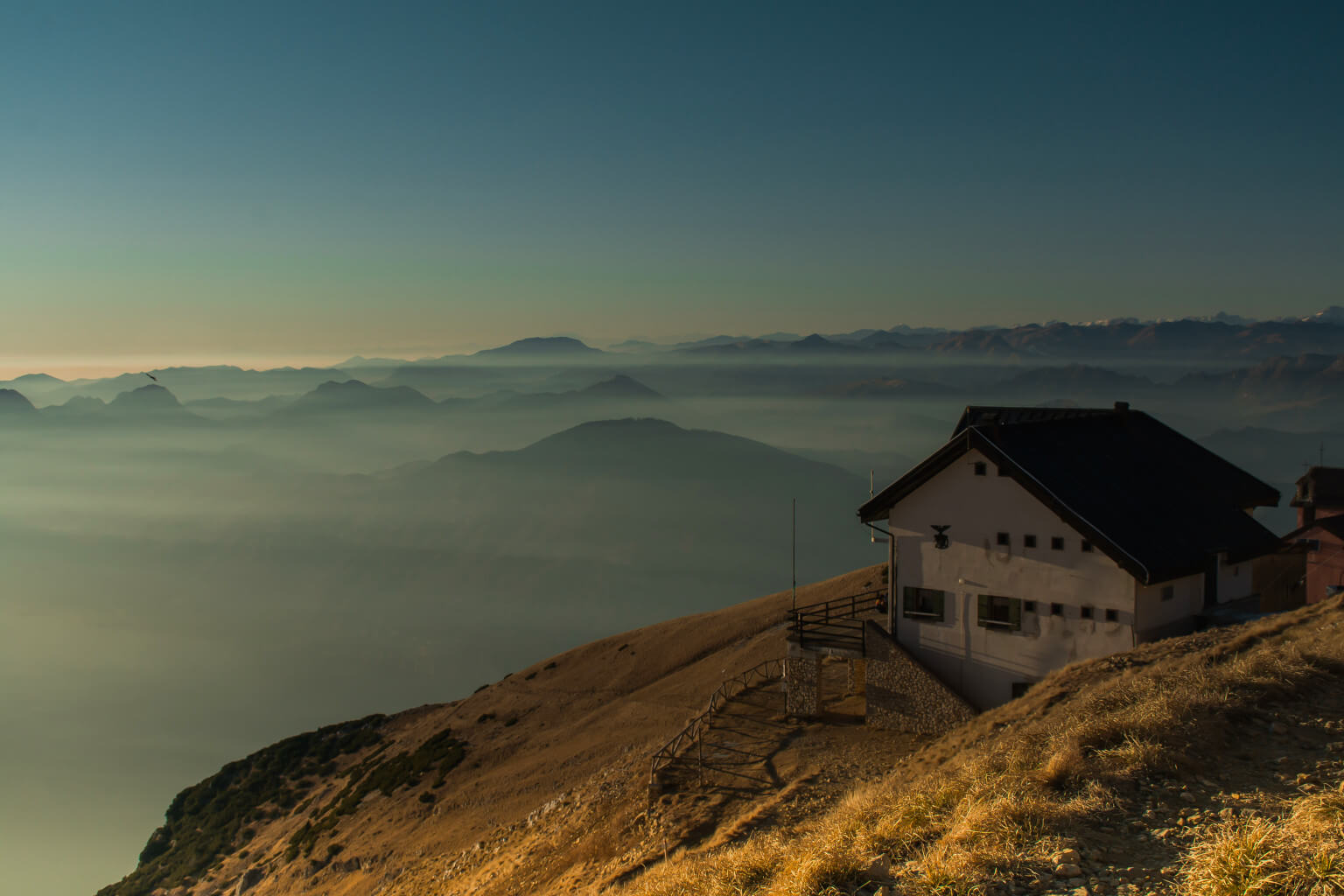
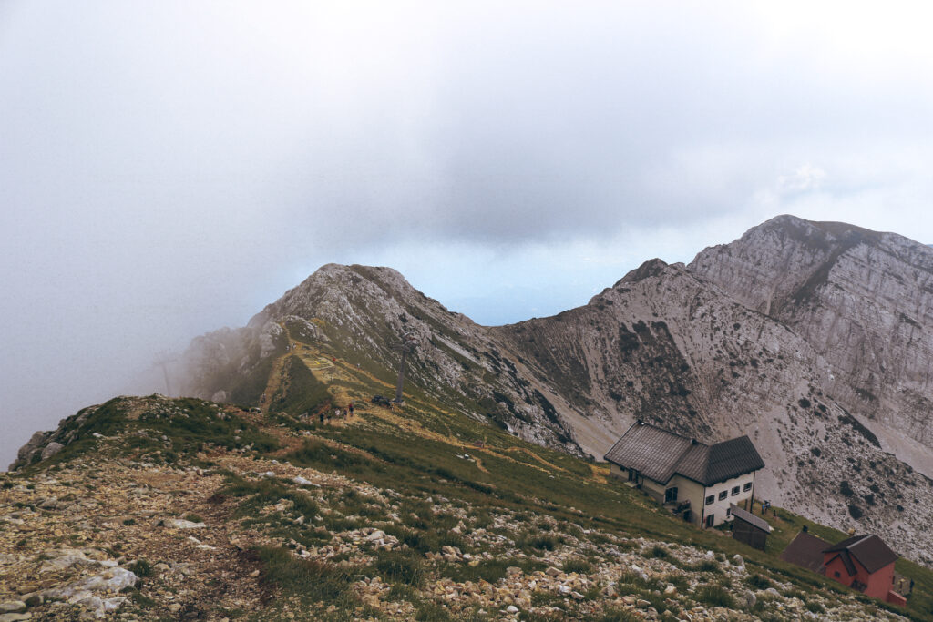
Rifugio Chierego (2147 m) is the one you see right behind, and you can reach it in more or less 20 minutes. To get to Cima Costabella you will need to take the path number 658, which starts from the side of Rifugio Chierego. On the mountaintop, an observatory shows you all the summits around you.
To go back to your car, you will have to retrace the path of going.
Ponte tibetano di Crero (Tibetan bridge)
If you still do not know which trekking path to take on Monte Baldo and you are not afraid of highs, this is the one for you! You can do this loop trail in both directions. In the one that I will describe you, the climb is on the path and the downhill on the road.
You can get to Crero by car following a small road where there are some parking spots. The trip will then begin from the eighteen-century San Siro Church you can find after crossing the village.
From here, follow the direction to reach the Ponte Tibetano di Crero through the Sentiero del Pellegrino (Pilgrim’s path). You will arrive in Val Valzana and you will need to cross it by using the Ponte Tibetano di Crero. Usually, a Tibetan bridge is made of three cables placed in a triangular shape. However, this one is different and easier to use because there is a metal walkways. It is a total of 35 meters long and 42 meters high.
The bridge was built in 2019 and it soon became one of the most popular places to visit on Lake Garda. Keep reading the article to discover how to continue your walk.
Keep walking and, after a while, you will find the path number 38 which with a mule track brings you to San Zeno di Montagna. Before arriving in San Zeno, take the path number 39 which leads you back to Crero to finish your loop trail. This last part offers amazing views of Val Valzana.
This tour is also possible on a mountain bike, but you will have to push the bike by hand to go through the bridge.
Rifugio Telegrafo
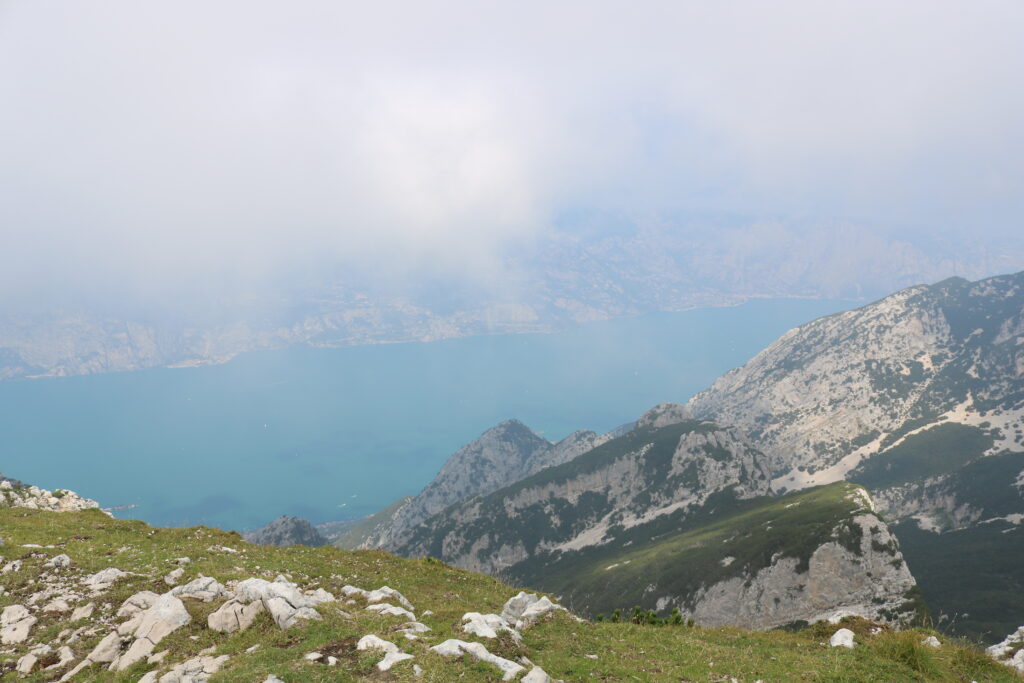
In the list of what to do on Monte Baldo, the trekking paths that reach Rifugio Telegrafo are the most satisfying ones. They all are on the side of the mountain overlooking the Val d’Adige. Therefore, the view of Lake Garda will be your reward once you reach the top.
The first trekking path I am suggesting you is the one from the Rifugio Novezzina. It is for intermediate and experienced hikers and I do not recommend it for people with knee injuries or little children.
You will need to follow the path number 657, which begins with a steep climb through a meadow. Then it continues inside the woods through Vallone Osanna. Here, there is a table where you can make a brief stop before the most difficult part.
The last part of the path is indeed rocky and with many sharp turns until the last climb to the hut. Near Rifugio Telegrafo, there is a small church and a lot of space where you can eat your packed lunch. However, I suggest you to go eat inside the lodge and try some typical dishes.
To go back to your car, follow the same path.
Many trails reach Rifugio Telegrafo. Keep reading to discover another way to get to this place to visit on Lake Garda.
The second trekking path starts from Passo Campione and it is the number 652. At first, it goes through a thick vegetation and then it continues along the mountain ridge. The last hour is the most difficult one.
At the crossroad with the path number 651 you are almost done! You still have to walk for a few meters and in 10 minutes, you will be able to admire the view. Lake Garda is right below you in all its beauty.
Just below the mountain ridge there is the Rifugio Telegrafo and the small church near it. The hut, opened in 1897, is probably one of the most famous ones on Monte Baldo.
To go back to your car you can follow the same path from where you came. Another option is to take the path number 651 following the Alta Via del Baldo until the crossroad with the path number 66. This one leads you to the path number 652, which is the one you took at the beginning. After a little while, you will be back to your car!
In both starting points, there are not many parking spots, so it is better to arrive in the early morning.
Forte San Marco
To complete the defensive line on the border with Austro-Hungary, the Royal Italian Army between 1888 and 1913 built Forte San Marco. During the Great War, the ancient fort did not take part in any battle. They fired just a few shots against Austrian planes headed to Verona.
From Osteria Zuane a military road after more than 40 hairpin turns reaches the fort. While walking, you will be able to admire the beautiful views of Lessinia, Val d’Adige, Lake Garda and all the other Rivoli’s forts.
Once you get to Forte San Marco, you can go inside. Just be careful because it is a private property and on Sundays there might be a soft-air battle.
If you want you can also reach the fort with a mountain bike or riding a horse.
From Monte Baldo to Malcesine
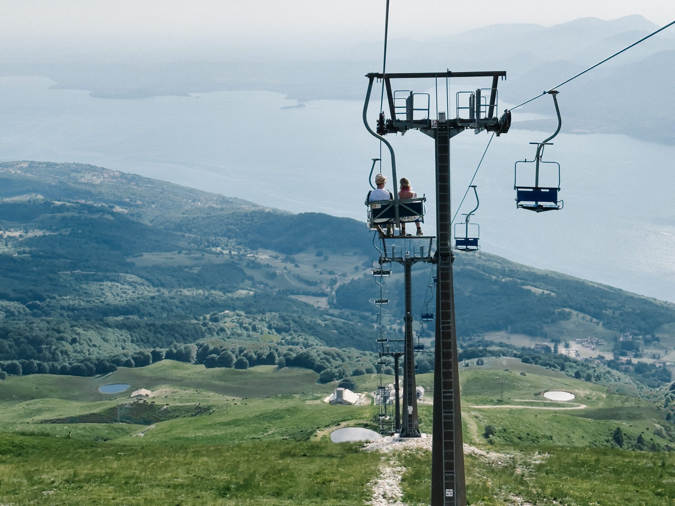
When you look up online “trekking on Monte Baldo” I am sure you will find articles talking about the cable car starting from Malcesine. If you do not want to struggle but you still would like to take a walk on Monte Baldo, I suggest you do this downhill path.
To reach the top of Monte Baldo, take the Malcesine – Monte Baldo Cable Car. Open from June to October, is the best way to reach one of the highest summits and enjoy an amazing view throughout the whole ride. You can find the prices of the tickets for the cable car on Monte Baldo on their website here.
If you decide to start your trip from Malcesine, there is a pay parking but it could be full in the summertime. On the other hand, if you take the cable car from San Michele, the intermediate station, it should be less crowded.
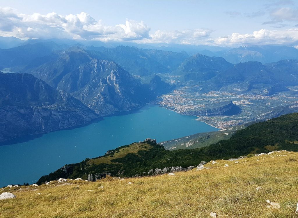
Once you reach the top, stop for a second and take a good look at the view around you. During bright days, you will be able to see a good section of Lake Garda below you.
Now let the fun begin! Keep reading to discover how to walk down from Monte Baldo to Malcesine: one of the most beautiful places to visit on Lake Garda.
Start your hike with the small climb to get to Colma di Malcesine following the path number 651. From here, walk along Monte Baldo’s ridge to reach one of the best panoramic viewpoints of the region.
Then, just before arriving at the asphalt road, take the Sentiero del Ventrar (number 3). Keep going downhill passing through Capitello S. Valentino and Capitello del Signor. At the crossroad, follow the paved road (number 2) until the next crossroad where you need to take the path number 2.4 on your left.
Soon after that, you will be in San Michele, where there is the intermediate station of the cable car. If you decide to park here your car, you have finished your excursion! Otherwise, from here you can continue on foot or with the cable car. If you decide to go with the first option, after the station take the road on the left. This panoramic road will bring you to Malcesine.
This excursion is not suitable for mountain bikes because on the Sentiero del Ventrar you will need to dismount the bike and carry it by hand.

Madonna della Corona
If you ask someone which is the best destination to reach with a trekking path on Monte Baldo, I am sure they will tell you that The Shrine of the Corona is a must-visit spot. Located in Spiazzi, it’s one of the most charming locations in Northern Italy. It is an overhanging church surrounded by the mountains. You can also see it from the Brenner Motorway if you look up on your left while going north.
Path number 73 starts from Brentino Belluno and after 1500 steps reaches the shrine. Until a few years ago, this was the only way possible. Nowadays cars can also reach the church. There is one thing that has never changed over the decades: you can always find many pilgrims praying along this path.
You will also pass through a small cavity called Grotta della Pietà (Mercy’s Cave) where you can sign the Libro del Pellegrino (pilgrim’s book). If you do not want to attend the mass, I suggest you go during the week because it will be less crowded.
Madonna della Corona, embedded in the rock, is one of the most beautiful places to see on Lake Garda. However, it is not the only one. Let’s have a look at the other famous trekking paths on Monte Baldo.
Vajo dell’Orsa
From Brentino, a small village in Val d’Adige, there is a loop trail around Valle dell’Orsa, the biggest valley on Monte Baldo.
Start your excursion by taking the path to The Shrine of the Corona which passes through a thick vegetation. Soon after, you will find the crossroad with the path to Vajo dell’Orsa. This trail arrives at the Tibetan bridge that allows you to reach the other side of the valley. The bridge was built to simplify the path because it used to be too difficult and too dangerous.
After crossing Rio Pissotte, you will find another crossroad where you can take the trail to Malga Orsa. A little further, upstream, there is the source of the small river. At the hut, I suggest you have lunch and eat something typical while looking at the view of the mountain slope. To go back to your car, go to the last crossroad and take the path to Brentino.
What to do on Monte Baldo if you are a mountain climbing lover? The faces of Vajo dell’Orsa are the most popular ones on Monte Baldo for climbers. In the whole valley, there are climbing walls for every level of expertise.
2. TRAVERSATA DEL BALDO – PEAKS OF MONTE BALDO TOUR
On Monte Baldo is also possible to do a multi-day excursion along the whole ridge. It is also called Alta via del Monte Baldo and it is the main path that connects Rifugio Altissimo and Rifugio Telegrafo. You can start from both huts, but in this article, I will describe the route that starts from Rifugio Altissimo.
Nago – Rifugio Altissimo Damiano Chiesa
If you are an expert hiker, start your adventure from Nago – Torbole. In Via S. Vigilio, in the direction of Torbole, you will find the Chiesa della Santissima Trinità. After the church, a road goes upstream on your left. You will be able to see a sign for “Strada del Monte Baldo” and another one for the parking. You can start your journey from there and take the path number 601 or park your car a little bit further. From this point to the Rifugio Altissimo there are almost 7 hours of walking.
Your first stop can be in Malga Zurès, which was one of the most used places along the defensive line during the Great War. You can reach it also by car and park there to start your excursion.
Then you have to follow again the path number 601 to arrive at the Parcheggio Stanga, another place where you can park your car.
Use again the path number 601 that will lead you to Monte Vargana. After walking along the ridge, you will get to the summit of Monte Altissimo. There, there is the Rifugio Altissimo Damiano Chiesa (2059 m) where you can spend the night.
Among the places to visit on Lake Garda, the Rifugio Altissimo is for sure one with the best views. Here, from 1889, the owners delight the hikers with their cuisine.
During this whole trail, there are many panoramic points overlooking Lake Garda… breathtakingly beautiful!
The last part of this path follows the Sentiero della Pace (Walk of Peace) along the front of World War I. You will also walk through the Parco Naturale Locale del Monte Baldo, a natural park where you can admire the biodiversity of the so-called Europe’s Garden.
Rifugio Altissimo Damiano Chiesa – Rifugio Telegrafo
After the night at the lodge, you should be ready to start again your adventure. The next stop will be the amazing Rifugio Telegrafo. To get there you will be following the famous Sentiero delle Creste (Ridge’s path).
From Rifugio Altissimo, take the path number 651 which will pass through Bocca Tratto Spino, which is where the cable car from Malcesine arrives. This could also be another starting point for your adventure.
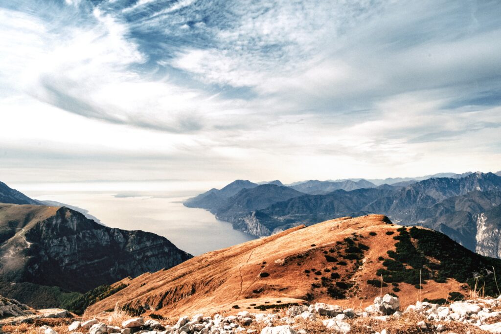
Keep following the trail and go through Cima delle Pozzette where there is an astonishing view of Lake Garda, the Alps, and the Apennines. The path will then continue on the ridge of the side overlooking Val d’Adige and you will pass through Cima del Longino and Cima Valdritta.
This last one is the highest summit on Monte Baldo, so I suggest you do a detour to reach the top. I know you will probably be tired, but when will you be here again?
At the end, to reach Rifugio Telegrafo (2147 m), you need to go back to the path number 651 and walk under Punta Pettorina.
Rifugio Telegrafo – Caprino Veronese
A nice meal and a great night of sleep were needed, but now let’s walk again!
Today’s trekking path is one of the most popular on Monte Baldo. Start by taking the path number 658. You will be walking under two of the most famous summits of Monte Baldo: Vetta delle Buse and Coal Santo.
The trail will then go around Cima Costabella. If you want, you could walk uphill and reach the top without extending your excursion by much. Once at the summit, there is an observatory.
Then you can come back down through the small path that reaches Rifugio Chierego (1907 m). From here, take again the path number 658 that will lead you to Rifugio Fiori del Baldo (1816 m).
Follow the path until Bocchette di Naole. Here you can take the road on your left to get to Forte di Naole which will then reunite with the main road. Otherwise, keep walking on path number 655 passing under Punta di Naole. Then, this path changes the number and it becomes the number 662, which will arrive to Caprino Veronese.
After three difficult but exciting days, you have completed your adventure! Great job!
Some additional information
The one that I have just described you is the full excursion. However, as you can see, there are different points from which you can start your journey to shorten it.
The best period to do the Traversata del Baldo is from May to September. I hope you will find beautiful weather with bright days to be able to enjoy this experience. The huts during this period are open, but I suggest you call in advance to make a reservation and be sure.
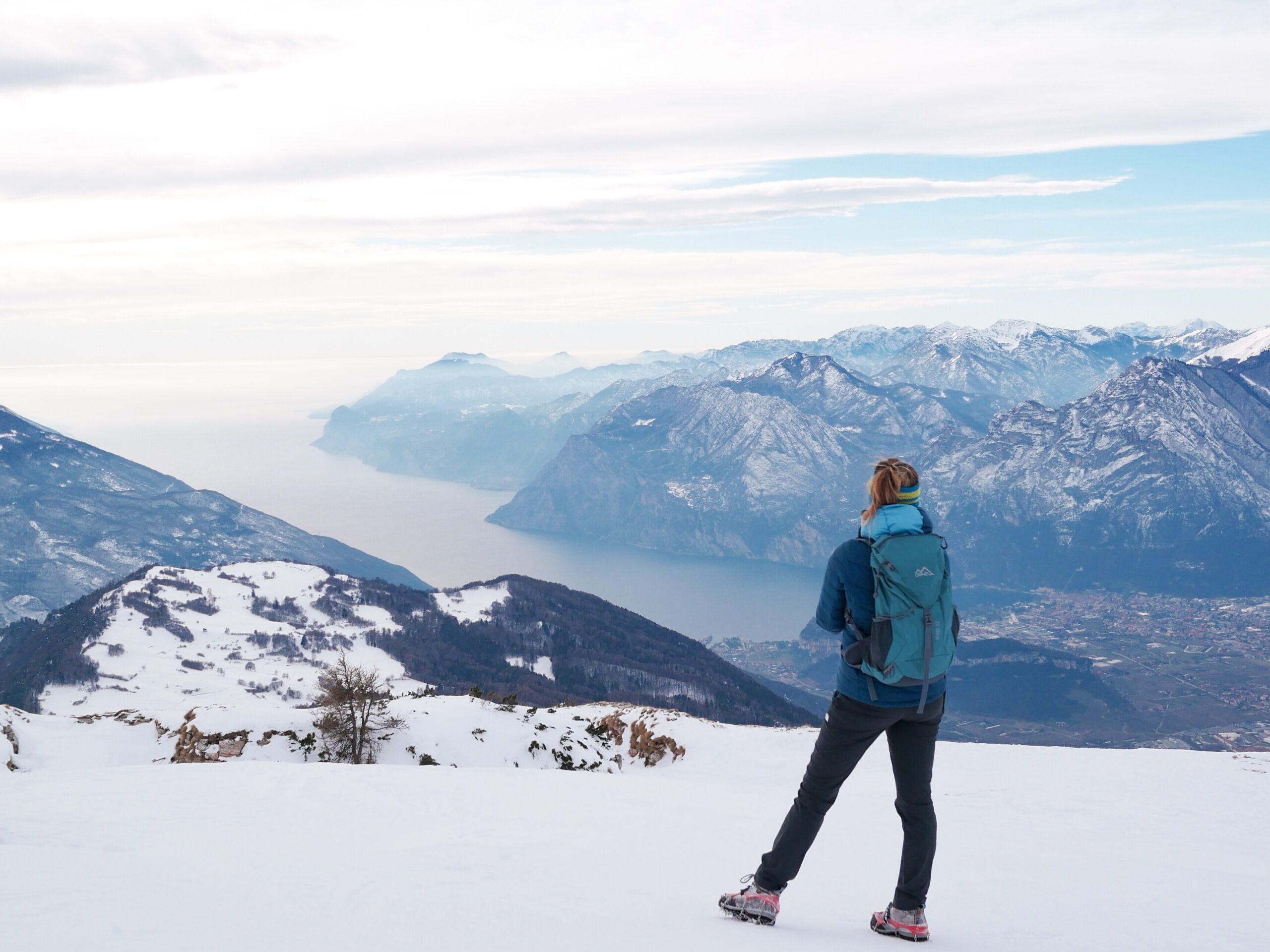
3. WHAT TO DO ON MONTE BALDO DURING WINTER
Monte Baldo is not famous just because of his trekking paths. In the wintertime, for sky and snowboard lovers there are 10 kilometers of ski slopes in a beautiful ski resort. You can reach it both from the Malcesine – Monte Baldo cable car or from Prà Apesina (Avio). This area offers slopes for all levels and a ski school for beginners or those looking to improve. If you like doing tricks, the Baldo Snow Park is perfect for you.
Otherwise, if you like to go off the beaten track and practice cross-country skiing or ski mountaineering, Cima Costabella is one of the most popular places to do that.
If you prefer to keep your foot in the snow and walk, you could do a snowshoe hike at the Anello della Colma. You can admire Lake Garda, Adamello, and Presanella from this easy and panoramic path. If you do not have snowshoes, it is possible to rent them at the information point near the ski school.


